Seaways Free Article: Running out of room?
How Maritime Spatial Planning can jeopardise shipping safety
by Raymond W P Seignette AFNIand Captain Harry W Tabak AFNI
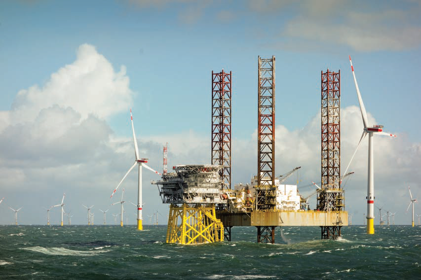
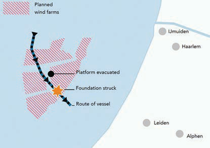
On 31 January 2022, the bulk carrier Julietta D broke away from anchor at IJmuiden during Storm Corrie, striking another vessel and drifting uncontrolled into a wind farm under construction before a tow could be established. This was classified as a ‘very serious shipping accident,’ and is part of an upward trend of incidents involving both ships and [multiple] fixed objects.
In response to this trend, the Dutch Safety Board initiated an investigation into risk management for North Sea shipping, focusing on the Dutch part of the North Sea, namely the 12nm zone and the adjacent Exclusive Economic Zone (EEZ). The study concluded that the present management of the risks that have been identified is inadequate, and that unsafe situations remain unidentified. In other words, the analyses used contain multiple gaps and do not recognise new developments. The Dutch Safety Board concluded that the results were ‘alarming’, and presented these to several EU coastal states who are members of the North Sea Shipping group, in Brussels in August this year.
A joint seminar held by The Nautical Institute and others (see box, left), found that while the study was restricted to matters affecting Dutch waters, its findings are relevant to international shipping, and to many coastal states engaged in maritime spatial planning (MSP).
One of the problems identified was that the voice of mariners was not present or heard. Another problem was that the current risk assessment process is not suitable for dealing with nautical risks from multiple objects, such as wind farm arrays, close to shipping lanes. Several international standards, including The Nautical Institute’s publication ‘The shipping industry and Maritime Spatial Planning – a professional approach’, need revision to take this into account.

A crowded sea
The North Sea is one of the busiest seas in the world. It includes some of Europe’s largest ports such as Hamburg, Bremerhaven, Amsterdam, Rotterdam, Felixstowe and the ports on the Western Scheldt.
The Dutch EEZ (Exclusive Economic Zone) zone encompasses the busiest traffic lanes and shipping routes of the North Sea. It includes the northern bound routes to Germany, Denmark, the UK and Norway, via Skagerrak to Sweden and Finland. The southern bound routes head towards The Netherlands, Belgium, the UK and France.
In the Dutch part of the North Sea, the risk of incidents has already resulted in the implementation of VTS, Traffic Separation Schemes (TSS) and other shipping routes, with very complex traffic junctions, shipping composition and intensity. This is mainly reflected in traffic lanes on the North Sea and in port approach areas, some of which extend beyond the territorial waters.

Drifting and collision - the Jullietta D incident
Image credit - Dutch Safety Board Report
Junctions leading to the port of Rotterdam see 70,000 vessel movements annually. The TSS leading to the port entry has an average 28,000 vessel movements in each direction per annum. This is not counting service, recreational and fishery vessel movements going on outside that TSS. The development of large future windfarms will result in additional traffic for the installation, construction, and maintenance phase. Present estimates are that a new windfarm will add 5,000 vessel movements on an annual basis.
Existing risk management measures
Between 2018 and 2022, a series of Nautical Risk Analyses (NRA) covering the Dutch EEZ and 12 NM Zone were carried out by the Rijkswaterstaat. These are in line with the risk-based approach for maintaining the safety level for shipping in the North Sea. The intent is that the highest risks should all be managed to an acceptable level. The following Risk Control Measures (RCM) were proposed:
- Periodically carry out NRA, network analyses and IMO Formal Safety Analyses;
- 1,87NM Safety and Buffer zone between the TSS and the windfarm boundary;
- Vessel Traffic Monitoring (VTMon) a passive VTS, focused in and around wind parks;
- ERTV (Emergency Rescue Towing Vessels) requirements;
- Promoting the use of a North Sea pilot on board;
- Temporary VTS located on offshore vessels during installation, construction, maintenance and decommissioning offshore structures;
- Above the Dutch Wadden islands: route differentiation advice for ULCSs (Ultra Large Container Ships), to prevent loss of containers;
- Identified passageway through wind parks; and
- Standardisation of Dutch AtoNs (Aids to Navigation) including sector lights for wind turbines.
The Dutch Safety Board Review had significant concerns with many of these proposed measures. These are discussed in more detail in the tinted boxes.
Outlook
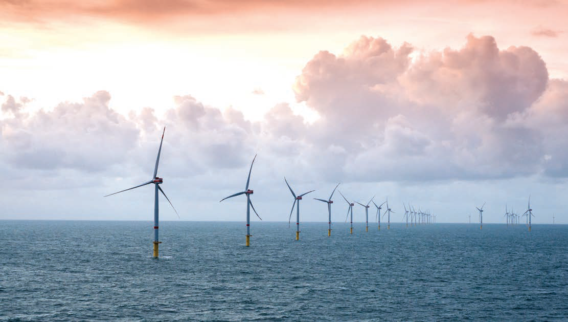
The political and social pressure to reach wind energy targets is urgent and compelling. Far-reaching plans have already been made to allocate available marine space in the North Sea to support this energy transition. There are currently 700 operational wind turbines within the Dutch 12 nm zone – a number which may increase to perhaps 5,500 by 2050. Tens of thousands of wind turbines are proposed across the North Sea as a whole. However, further details are presently unavailable.
In addition to this, a large variety of offshore activities will have a claim on the North Sea domain, including fishery, offshore oil and gas exploration, anchored floating solar fields, subsea field tidal current generators, anchored wave and swell generators, dedicated military training areas, areas for sand, shell and gravel extraction, offshore farming for fish and shellfish, plus environmental protection areas and artificial islands for the North Sea wind power hub.
It is expected that common practice for shipping in the North Sea will become much more dynamic and complex over the coming decades. The distinction between shipping traffic in a TSS and shipping traffic in the major European seaports will change. As traffic intensifies, the areas will merge into a single ‘industrial’ zone. This could have an impact on UNCLOS.
In the North Sea of the future, the navigator will operate in a channelised TSS between wind farms, oil and gas exploration platforms and other new developments. There will be less space for ship handling and manoeuvring, and greater difficulty in finding a safe position to ride out storms. There will be fewer waiting spots and/or controlled drifting areas. In the future channelised TSS, incidents could result in traffic congestion, blocking of the TSS traffic lane and a limitation of port accessibility. The operational context may be further complicated due to technical developments such as Maritime Autonomous Surface Ships (MASS) and Port Call Optimisation (PCO) affecting ship speeds and traffic density.
To safely guide and monitor large wind-sensitive and/or heavy ships in a TSS close to wind farms, the following risk control measures could be considered, in addition to those which are already established:
- Establish a separate traffic lane in the outer edge of the TSS;
- VTS to guide, monitor and inform all surrounding traffic (IMO & IALA);
- Defined reporting points in TSS;
- Upgrade status of wind-sensitive or heavy vessels sailing in these waters to 'restricted in their ability to manoeuvre and maintaining of safety of navigation in those areas';
- Consider mandating the use of well-trained, skilled and competent North Sea pilots in defined circumstances;
- Prediction software for assessing vessel handling and manoeuvrability, to be used by the Master to enhance the vessel's resilience in critical circumstances;
- Shore based prediction software for assessing how traffic conditions are affected by hydrological, hydrodynamic, and meteorological circumstances, to be made available through VTS services;
- Risk control measures (RCM) in the North Sea should be standardised and harmonised. It should be noted that RCM are currently written from a shore based regulation perspective, rather than from an operational or technical perspective.
- Investigate additional equipment requirements under SOLAS to increase vessel reliability and critical system redundancy.
Gaps in stakeholder consultation
The Dutch Maritime Spatial Planning process assesses the effects of windfarm placement on shipping under ‘environmental effects’. The effects of the new fixed objects – and their claims on navigable space – on shipping safety as such were not assessed in this procedure. The indirect effects on shipping safety in TSS and other hotspots were not investigated.
At the end of the Environmental Impact assessments (EIA), questions are raised about the completeness of information, and knowledge gaps regarding the consequences of collisions. The knowledge gaps were recognised in the decisions taken, but it was noted they had no consequences for the actual decision-making.
Common law of shipping
At the seminar, MARIN showed results from network analyses of (historical) shipping traffic routes in which the planned plots for offshore installations interact with many ship traffic routes. The plots for planned wind farms will become restricted areas for vessels, which will need to find other, mostly longer alternative routes. Trade patterns may need to be changed, economies of scale need to be reconsidered, and the extra costs for shipping may need to be compensated for.
The starting point of current Dutch policy is to enable multiple use of the MSP space in the Dutch part of the North Sea. In the process that followed, UNCLOS was made secondary to this policy. The spatial assignment of offshore wind farms took preference over recognised TSS essential to international navigation. As a consequence, shipping safety, particularly the safety of navigation, may be adversely affected by the MSP process. This should be recognised by the competent authorities.
Precautionary principle
To deal with the uncertainties and risks which are not manageable by public rules, the research suggests application of the precautionary principle in this maritime domain. This means that new risks resulting from future technologies and their applications need to be proactively identified and countered, rather than reactively dealt with in response to accidents and near misses. The classical risk approach, including formal safety assessments such as the IMO-FSA and IALA risk toolbox, should also be reconsidered. In assessing the probability of hazardous scenarios, policy makers should not restrict themselves to assessing empirical data only.
A new risk approach was proposed, in which risks are viewed as an intrinsic aspect of the activities and the operational setting. This implies a thorough understanding of the activities concerned in their operational setting. An extended risk approach was introduced by the Netherlands Scientific Council for Government Policy in 2008, showing how to assess and value new risk problems and uncertainties.
Based on this review, the following conclusions are identified:
- Future innovative developments correlated with present users in the North Sea create new uncertainties for shipping safety.
- In guarding shipping safety, dealing with uncertainties should be included (as good seamanship requires).
- The current approach to assessing risk, and the overall risk-based approach of the Dutch Government deserves reconsideration.
- Scenario thinking is required, using input from expert sessions to develop multiple incident scenarios (common- and worst-case scenarios), and correlating the quantitative and qualitative outcomes of all assessments to handle uncertain risks.
- Scientists, policy advisers and policy makers should adopt an uncertainty-tolerant attitude.
The MSP process should be revised to help secure the safety of navigation in the North Sea, provide a consistent and all-encompassing approach for both those onboard ships and those monitoring shipping ashore, and to prevent jeopardising shipping safety.
We hope that The Nautical Institute, as a representative of the global seafaring community, can take the lead in raising awareness of this issue and facilitate opinions and reactions from the seafaring community to serve as valuable input in reshaping the MSP process and policies.

